The following on-line links should help your historic mapping search of our local Halton Hills area, the County of Halton or other areas of the province. You will want to look for maps that show ownership and any details identified on the map relative to the property. You will need to know the original lot and concession number to locate your propert
• Patent Plans (the original grant from the Crown to a property owner) can be found at http://www.archives.gov.on.ca/en/about/patent-plans.aspx
• Tremaine’s maps from the 1850s -1860s can be found on a Google search or at the local archives. Our 1858 map can be found hanging on the wall in the History Room in the Georgetown Library.
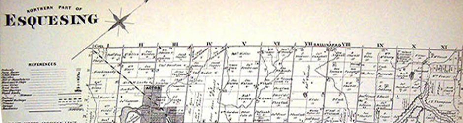
• County atlas maps from the 1870s – 1880s can be found at http://digital.library.mcgill.ca/CountyAtlas/searchmapframes.php The Halton County Atlas can also be found in the History Room
• National topographic maps can be found at https://ocul.on.ca/topomaps/collection/ and sometimes at http://geo2.scholarsportal.info/ We have a collection of these maps in the EHS archives in the library.
• Fire Insurance Plans are found at https://library.mcmaster.ca/collections/fire-insurance-plans They can be found in local archives but the EHS does not have a copy in our local archives. We do have maps of Georgetown, Acton and Glen Williams.
• Aerial photographs, including the 1954 aerial photographs of Southern Ontario are found at https://mdl.library.utoronto.ca/collections/air-photos/1954-air-photos-southern-ontario/index The EHS also has several aerial photos in our collection.
• Plans of subdivisions and Town maps are also available in the EHS Archives.